River Drone Test
 Unmanned surfaces vessels have a key role to play in “the future of surveying” according to PLA port hydrographer, John Dillon-Leetch, following a live demonstration on the Thames in Gravesend last month.
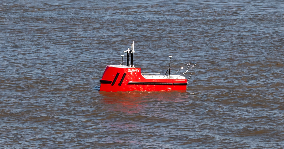
Cornish company Unmanned Survey Solutions demonstrated its hydrographic surveying vessel Accession, with a live feed of data and video direct to on shore participants.
John said that the unmanned vessel has the same sonar system as the PLA’s manned vessels, Maplin and Thame. “At a fraction of the size, the remote unmanned vessel can access areas that weren’t accessible before to this level of survey capability, changing the way we survey the riverbed,” he said.
Unlike Maplin and Thame, Accession is battery powered so releases no carbon emissions and is robust enough to work in rough offshore and coastal conditions.
Students from University College London who are studying a Hydrographic Surveying MSc, also participated in the trial.
The students, from all over the world, normally carry out practical work with the PLA as part of their degree, but due to COVID-19, this had to be carried out remotely. They carried out their practical work by participating in projects with PLA hydrographers onboard Maplin and Thame and were able to remotely control Accession from their desks in China, Singapore and elsewhere. “As future hydrographic surveyors, this was a real positive for them, the PLA and UCL to be able to offer this insight into the newest technology available in the industry,” said John.
The PLA’s acquisition of an unmanned vessel would mean it could expand its survey capability of its statutory work and its commercial customers, and survey 20-30 percent more area per day in the outer estuary.
“For us at the PLA to ensure safety of operations, we would not be seeking to operate in full autonomous mode, but for the unit to be operated by our experienced vessel teams to improve the efficiency of the work we do. This is a model we are also introducing for our surveyors and crews through the use of aerial survey drones,” said John.

