Aerial drone scans
 Drone technology has helped our hydrography team secure detailed photomaps of three wharves in east London.
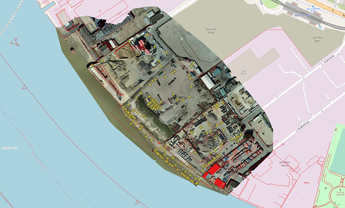
The aerial scans of the trio of assets – Peruvian, Plaistow and Royal Primrose wharves in Newham – will provide our engineering team with the geo-referenced, scaled data they require, in advance of planned improvement works. The footage captured the Thames foreshore and land within the PLA property boundaries.
The task was completed with help from vessel traffic services colleagues at the PLA, National Air Traffic Services, London City Airport Air Traffic Control, the Metropolitan Police and land tenants.
Port hydrographer John Dillon-Leetch said: “With the help of our new, state-of-the-art drone and processing capabilities, Tom Ochman and Rob Spicer collected 2,100 hi-res images and surveyed in 160 ground control points to an accuracy of 2cms from 70m in the air which is just amazing! This capability is a real game changer for us now having commercially trained drone pilots who are marine surveying professionals support this level of work for our civils and estates departments.”
This data will be used to support multiple follow-on project requirements including site investigations, generation of site design plans, and site baseline data for change monitoring as well as for our hydrographic and other survey and mapping tasks. It also continues our focus on the management of our whole estate and supports requirements of our customers and stakeholders.
The work follows similar successful operations at East Tilbury and Dartford Creek earlier this month.

