Geotechnical and Geophysical Data
Need Geotechnical or Geophysical data?
- GeoChirp 3D Surveys
- Generation of Isopach layers
- Cone Penetration Tests
- Coring
- Multi-Channel Boomer
- Single Channel Chirp/Pinger
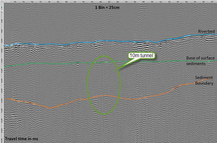
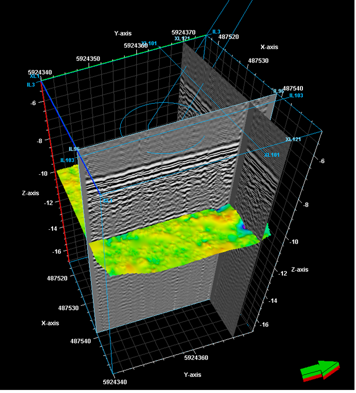
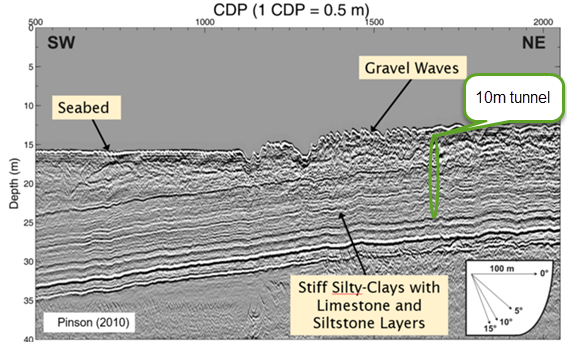
GeoChirp 3D Surveys
Need high resolution image of the sub-surface (<10m)?
The PLA can acquire a 3D CHIRP survey.
Benefits:
- A subsurface image with 12.5 (or 25cm) horizontal resolution
- The acquisition of GeoChirp 3D data will open opens up for extraction of geophysical properties and object detections.
Deliverables:
- Report
- Geotiff of GeoChirp 3D Coverage
- Processed 3D SEG-Y files (NMO and migrated).
Generation of Isopach layers
Need know the depth to a sub-surface layer to de-risk engineering design?
 The PLA extract geophysical horizons from 2D and 3D seismic data.
Benefits:
- Allow accurate calculation of required pile depth
- Reduce the risk of surprises during the construction phase
Deliverables:
- XYZ isopach layer of the top sediment boundary
- Geotiff of GeoChirp 3D Coverage
- Processed 3D SEG-Y files.
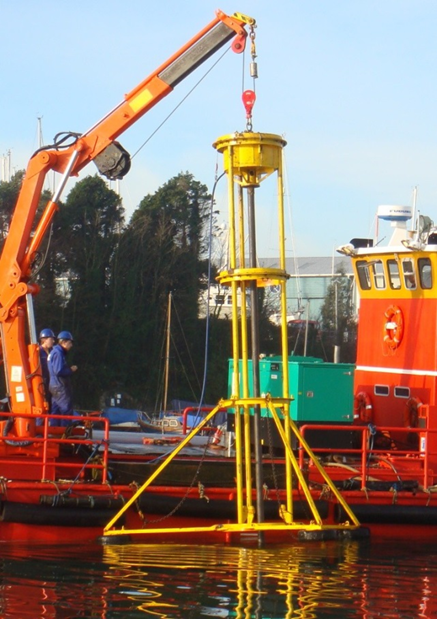
Cone Penetration Tests
Need to know the strength of subsurface material for engineering works?
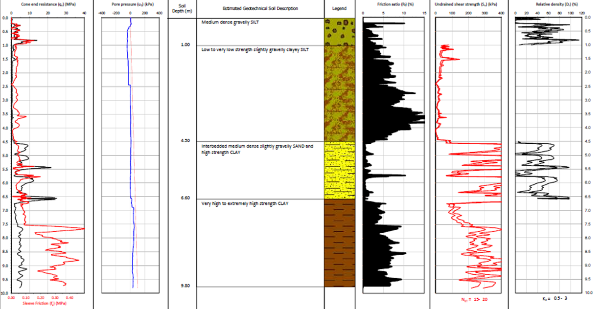 The PLA can conduct Cone Penetration Tests using a coiled tube CPT unit.
Benefits:
- Deployed from vessel
- Reduced risk for engineering works
Deliverables:
- Report
- CPT data is converted in AGS format and interpreted logs produced.
Coring
 Need to obtain a subsurface core for analysis?
The PLA can acquire cores using a VibroCorer unit.
Benefits:
- Deployed from vessel
Deliverables:
- Report
- Cores
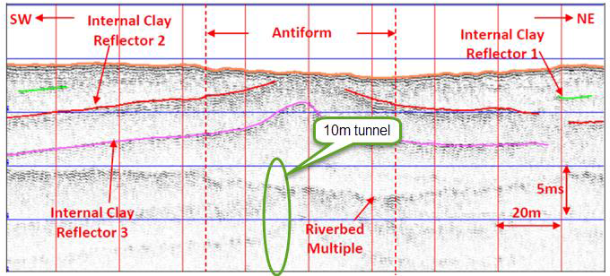
Multi-Channel Boomer
Need to image the subsurface to 10s of meters?
 The PLA can acquire a 2D seismic profile using a multi-channel boomer system.
Benefits
- 10s of meters imaged (dependant on sediments)
- True depth imaging, derivation of ground model with attenuation and velocity calculations
Deliverables
- Report
- Processed 2D SEG-Y files (NMO and Migrated)
- True depth imaging (optional)
- Ground modelling with velocity and attenuation (optional)
Single Channel Chirp/Pinger
Need a 2D image the subsurface to <10 meters?
 The PLA can acquire a 2D seismic profile using a single channel Chirp or Pinger system.
Benefits
- Penetration to ~10m (or approximately water depth due multiple)
- High frequency (16kHz+) giving high resolution
Deliverables
- Report
- Processed 2D SEG-Y files
- Stratigraphic interpretation

